Geographers have estimated the likelihood of a land border with Japan
The southern tip of the island of Kunashir on the Kuril Islands is gradually growing due to sand sediments, but even with the preservation of the growth rate of land for the formation of a land border, we would talk about millennia, experts told RBC
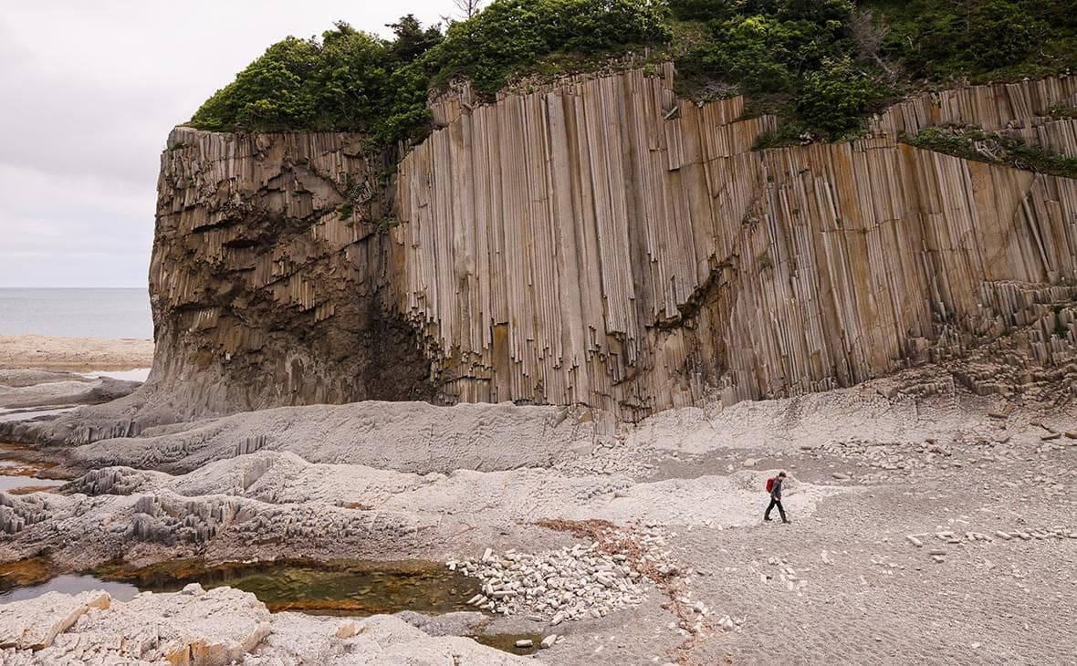
The southern tip of Kunashir, the southernmost of the Great Range of the Kuril Islands, is indeed gradually increasing due to sand sediments, this process has long been known, but it is impossible to talk about the prospect of a land border with Japan for natural reasons, experts told RBC. The assessment of the imminent appearance of a common border led Shot.
This [the possibility of a land border between Russia and Japan] is not just exaggerated. Well, look, the island grows at 5 m per year, and the width of the strait is 24 km. So count it. There's definitely not enough for our age. A land border with Japan, at least because of nature, will not exactly arise, said Sergey Mukhametov, senior lecturer at the Lomonosov Moscow State University’s Faculty of Geography.
He agrees with the Vice-Rector of the Moscow State University of Geodesy and Cartography (MIIGAiK), Doctor of Geographical Sciences, Professor Natalia Serditova. According to her, the distance between Kunashir and the Japanese island of Hokkaido is about 16 km and “even if the observed rate of land growth is maintained, we would talk about millennia.”.
“You cannot simply take the speed at which the coast has advanced over the past half-century and extend it several thousand years ahead. As the outlines of the banks change, the currents, the nature of the disturbance and the conditions for the accumulation of sediments will change. Moreover, at a certain stage, the accumulation may slow down or be replaced by erosion. Therefore, it would be premature to talk today about the possibility of forming a land connection between Kunashir and Hokkaido as a real geographical forecast, Serditova said.
Mukhametov said that the coastline of Kunashir has grown by about 380 meters over more than 50 years, mainly on the south side. “This is Cape Paltus and, accordingly, the Weslovsky Peninsula. And on this peninsula Veslovsky has Cape Veslo, it is so named for its characteristic shape. So it in the direction of the Strait of Treason is growing by about 5 m per year, the geographer said.
He noted that the strait itself is difficult to navigate: along the fairway, the minimum depth is about 7 m, and it is also worth taking into account the tides, ground movement, fog, currents.
Scientists have linked the growth of the southern tip of Kunashir with the accumulation of sand sediments.
“This is a natural process characteristic of sea coasts, where sediment transfer and accumulation are actively taking place. Waves destroy coastal ledges, including the Golovninsky cliff, and the resulting material gradually moves along the shore and is deposited where favorable conditions exist for this. This is how sand braids, shoals are formed, individual land areas are gradually increasing. Of great importance here are the wind and wave regime, coastal currents, the frequency and intensity of storms. Moreover, coastal processes are very variable: for example, in one area, the sea recedes, in the next, on the contrary, it can destroy the shore. Therefore, even within the same island you can see a completely different picture. For Kunashir with its rather complex natural conditions, this is quite natural, Serditova explained.
At the same time, she stressed that the land area on a particular section of the coast is increasing, the island itself is not moving anywhere. According to her, due to these processes, the configuration of the coast and the relief of the seabed are changing.
“New shoals are emerging, depths are being redistributed, and this is already directly affecting shipping. Especially sensitive to such changes ships with a large draft. But to assess how much the conditions of passage through the Strait of Treason have changed in recent decades, it is necessary to compare the hydrographic data of different years. Coastal ecosystems are also changing. On new land areas, plant communities are gradually formed, new habitats are emerging. At the same time, the habitat conditions of marine organisms in shallow water can change, the geographer added.